Charting the landscape.
Malta is a spit of land in the middle of the Mediterranean, so small (at 316 square kilometres) that it was sometimes left out all together when foreign cartographers designed their atlases, almost as if it wasn’t worth the trouble to peer at closely, take measurements, and lay out its longitude and latitude. That wasn’t always the case, of course, and Malta’s position in the gallery of maps turned out to be directly related to its influence on the European stage. Today, the islands have submitted to dramatic modern changes, but a squint into the past allows us to glimpse what once was.
1. Before the Great Siege - 1536
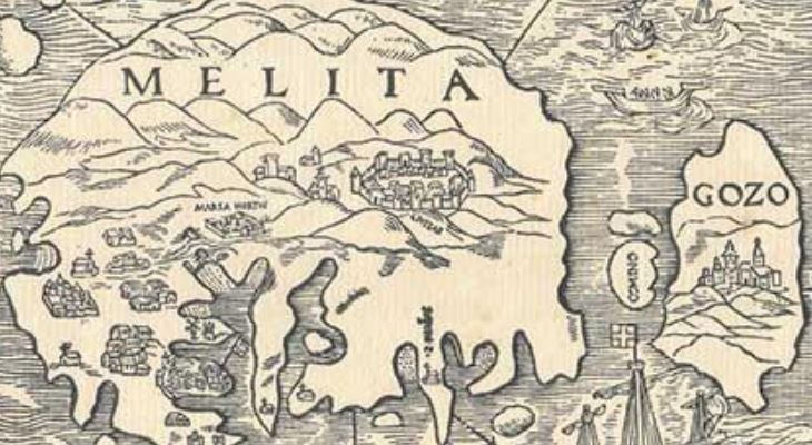
As reproduced in Albert Ganado's paper The Map of Johannes Quintinus Haeduus and its Derivatives
Taking a look from the perspective of Northern Europe, from the shores of the Italian peninsula, Malta – or Melita as it was known – seems pretty bare. This wood-cut map, drawn in 1533 by the Frenchman Johannes Quintinus and published in Lyons in 1536, is known to be the first of its kind to be printed. It’s primitive layout and spatial distortions may leave much to be desired for the modern viewer, but its focus on Civitas (Mdina) and Marsa, as well as bobbing fishermen, tells the story of an island engulfed by and dependent on the sea, seeking to protect itself from invaders.
2. Vibrant views of the 1565 Great Siege – 1580-1583
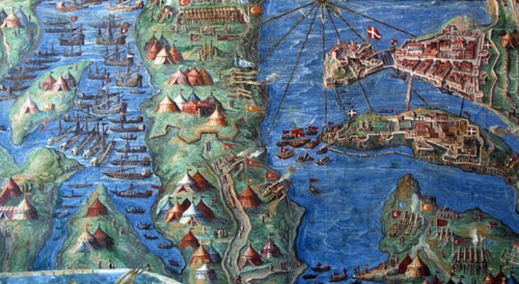
Atlas Obscura
The gallery of maps in the Vatican in Rome may be one of the oldest testaments of a world which has long come to pass. Commissioned in 1580 by Pope Gregory XIII from Italian cosmographer and priest Ignazio Danti, this cartographic wonder – 40 panels of maps in a long gallery of 120 metres – is the world's largest pictorial geographical study and it places an image of Malta right at the heart of the church. This view of the 1565 Great Siege of Malta is a colourful rendition of the battle which rocked the Mediterranean island. The details depicted – such as the battle encampments, ships traversing the Grand Harbour and the towns of Isla and Birgu – give a sense of the scale of an event which has shaped Maltese history for centuries.
3. Illustrating the sunset days of the Knight’s rule - 1761
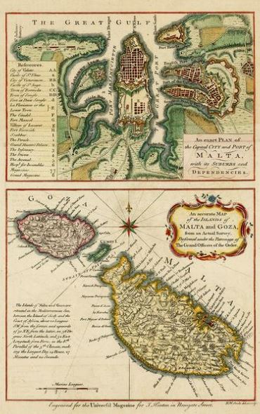
Turan Oral & Old Maps / Pinterest
Almost two centuries after the siege, years during which the islanders and the Knights fell into the comfortable lull of collective living, changes began to appear on the horizon. The order – unbeknownst to them or their hosts - would only be in Malta for another 25 odd years; the rumblings of hunger and anger in France would rock Europe and precipitate a wave of changes which would reach this corner of the Mediterranean, bringing Napoleon to its shores.
But, this 1761 map of Malta, with its focus on Valletta and the three cities, looks inward, to the grid-like streets of the capital, marking out the fortified defences around the Grand Harbour. The centre was, indeed, this spot of land by the sea. One of the ‘suburbs’ also included in the image is Sliema – distinctive by its lack of, well, anything really.
4. Malta during the British period - 1835
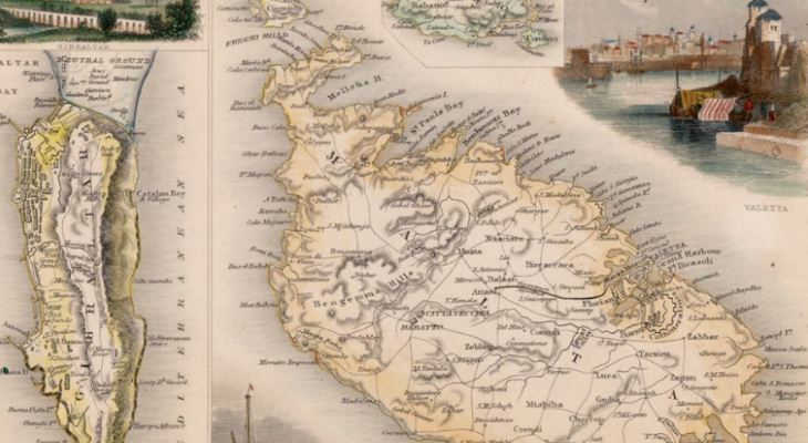
Barry Lawrence Ruderman Antique Maps Inc.
The British knew a thing or two about cartography. In their quest for world domination, they measured, they tracked, they drew, they mapped the world to own it and lay claim upon it. This image, from 1835, drawn by famed cartographer John Rankin, who would also create images of Jamaica, the West Indies and various parts of the United Kingdom, is a detail of a larger decorative chart illustrating the “British possessions in the Mediterranean Sea” and including Gibraltar, Corfu, Vathi in Ithaca, as well as Malta, with a rarely seen drawing of the Valletta Harbour, a picture which would not look out of place in a film look book.